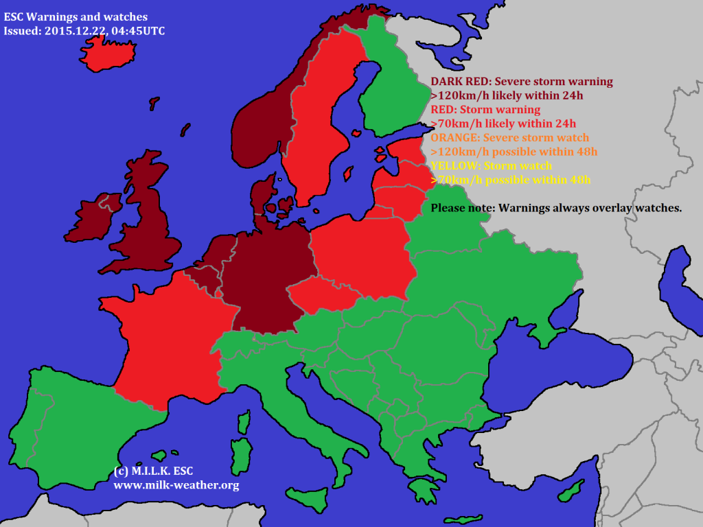
Windy weather is to be expected in (northern) Europe in the coming days, currently thanks to the severe storm BJARNI, which has already caused intense gusts over 170km/h in the UK. Warnings have been issued for large parts of Europe. Please note that the wind is usually strongest at the coasts, on mountains, open fields and other exposed places and that a warning does not mean that this intensity is expected everywhere in the country.
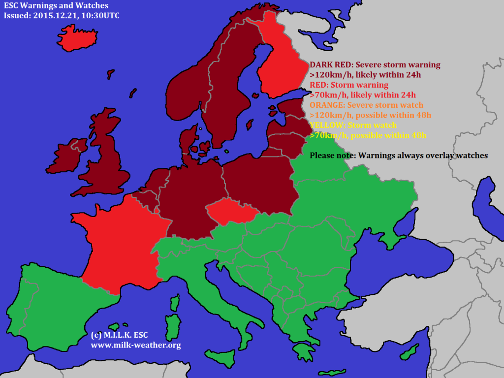
2015.12.21 – Overview: A lot going on in Europe
A lot is currently going on in Europe, with ESC tracking three storms at the same time, and having issued warnings for a large part of northern Europe. Please note that the strongest winds are always to be expected on mountains, at the coasts and in open areas. The storm to the west of Iceland is expected to lose its intensity, however the one to the south wil continue to move through Europe. See below for the ESC Overview!
2015.12.19 – Storms YORRICK and ZWI
ESC is currently tracking two storm in Europe – YORRICK and ZWI. YORRICK is now moving out of the area that ESC coveres, however has caused blizzard conditions in Northern Scandinavia last night, with gusts reaching 144km/h in Norway.
ZWI is currently moving towards the British Isles, peak gusts of 122km/h have already been registered.
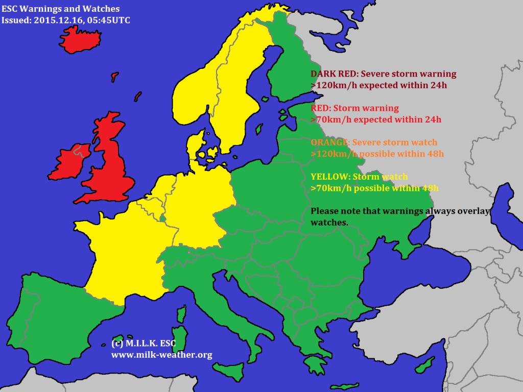
2015.12.16 – Storm YORRICK
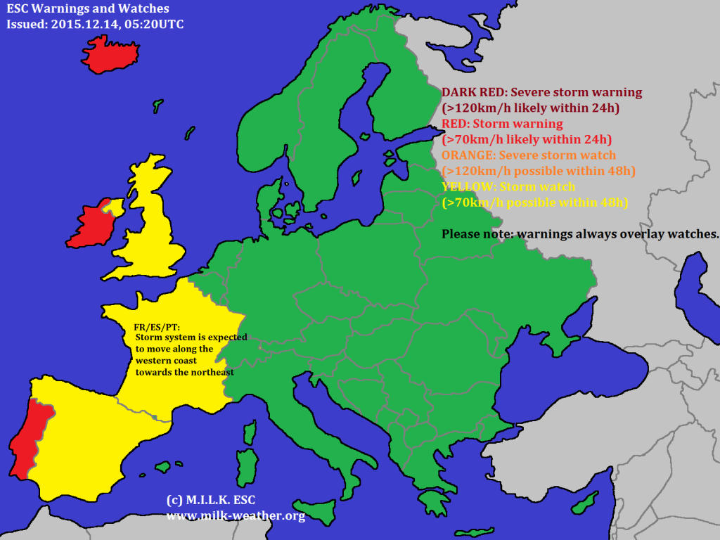
2015.12.14 – ESC Overview with two storms
2015.12.12 – Berlin: WARNING regarding STORM GUSTS / WARNUNG vor STURMBÖEN
2015.12.10 – Severe storm VANECHKA
2015.12.09 – Gust Analysis
2015.12.05 – Severe storms TED and SHIGERU
Both severe storm currently active in Europe, TED and SHIGERU, have intensified since the last ESC overview was published. Peak gusts of close to 210km/h have been registered in the UK, with the central pressure of “TED” dropping to 940hPa near Iceland. Storm SHIGERU has also rapidly intensified. There have been a few changes to the warnings issued for northern Europe.


