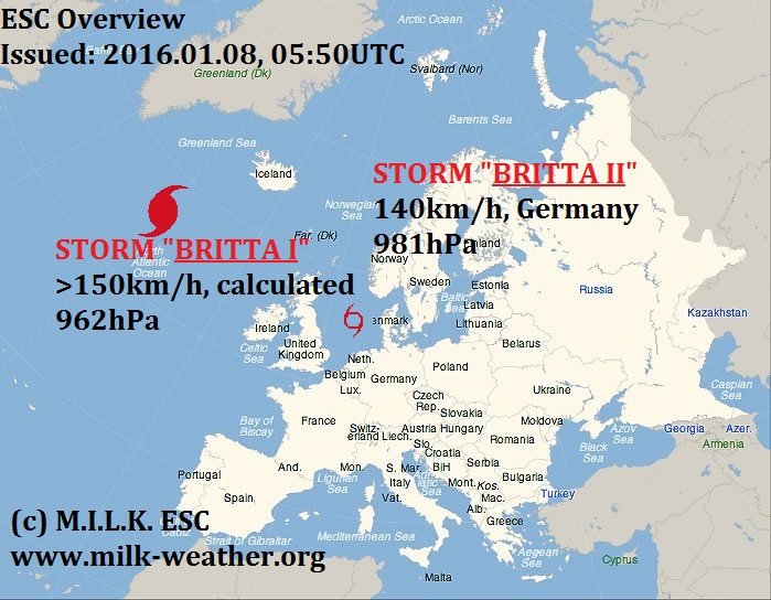
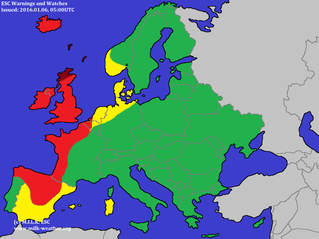
Storm BRITTA, currently located over the North Atlantic, is at this time the only storm in the region that ESC observes. It is not especially strong, however a few warnings and watches have been issued.
2016.01.08 – The storms BRITTA
2016.01.06 – Stormy in the West
2016.01.05 – ESC Overview: No Storms
Winter Break!
The M.I.L.K. Weather winter break has started yesterday and will continue until the 5th of January. In this time, the regular forecasts, warnigns, observations (etc.) will not be issued. This also affects the ESC. However, there will be updates on the weather situation that you can find on the MILK Now blog as well as the live data available on the MILK websites. We wish you a happy new year!
2015.12.29 – Overview: New and extremely powerful storm
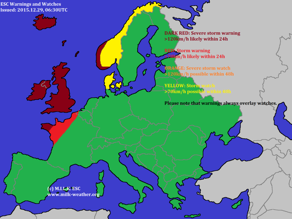
As the nameless severe storm that was the main issue yesterday is now moving away to the north, while still causing gusts around 160km/h on exposed Norwegian mountains, a new storm, named “ECKARD” is now approaching from the west. Even though the central pressure is still 973hPa, it is expeccted to drop to under 945hPa wihin the next few hours, and the wind speed is forecast to extremely pick up. Hence, there is a lot of wind to be expected in the British Isles. Below are the ESC Overview and the ESC Warnings and watches.
2015.12.28 – ESC: Windy in the West
There is only one storm system within the ESC map currently, with a central pressure of 971hPa and gusts reaching up to 120km/h in the UK. However, a new storm system is forecast to come accross the Atlantic today, and bring a lot more wind – it will be in tomorrows ESC overview. For now, below are the ESC overview as well as the warnings and watches. Stay safe!
2015.12.27 – Overview: Windy weather to be expected in the west
ESC Is currently tracking three storms in Europe and the northern atlantic. Storm DANIEL is now moving twoards the east, and is currently affecting the coast of Germany as well as Denmark. At the same time, there is a fairly powerful low pressure system near Greenland, with peak gusts close to 130km/h being reported from Greenland. Locally, higher wind speeds can be expected. Currently most concerning is the severe storm located to the southwest of Ireland, as it is expected to continue moving towards the northeast and hence affect the British Isles (and later the coast of Norway). Warnings and watches have been issued.
2015.12.26 – Overview: Severe storm DANIEL
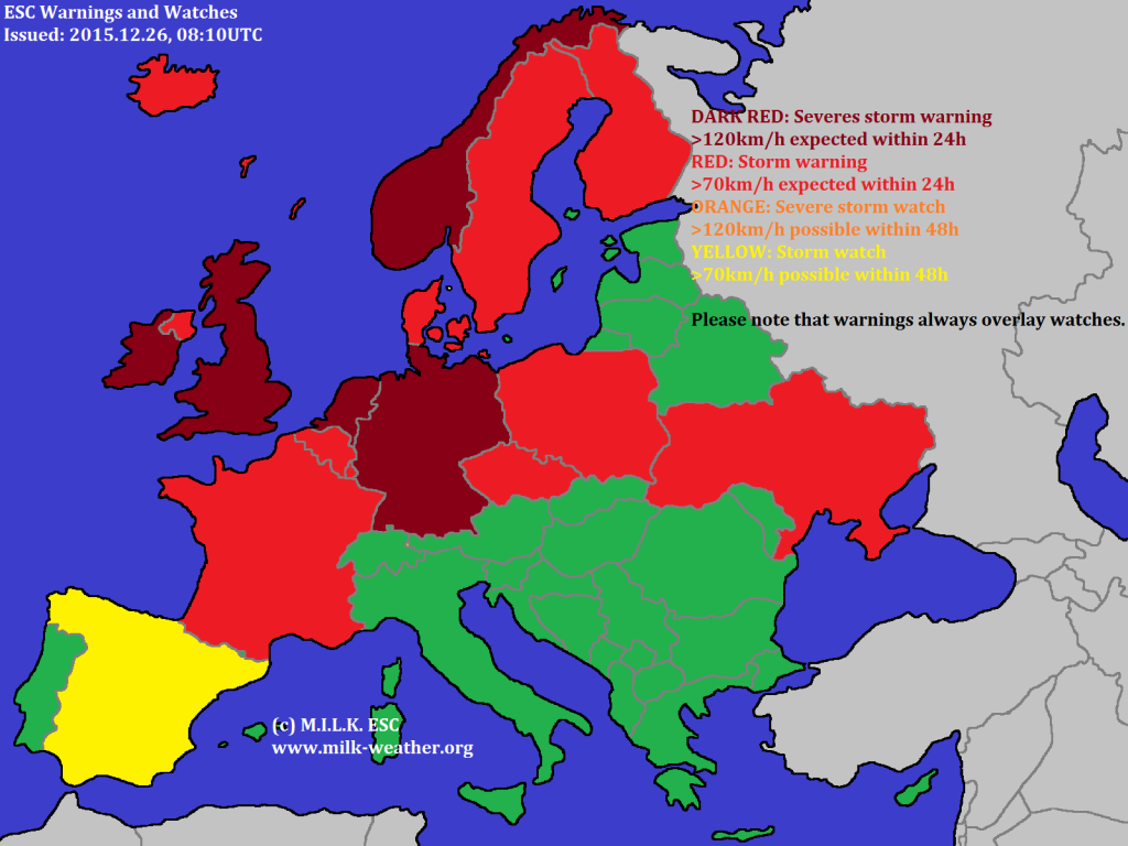
ESC is currently tracking only one single storm on the ESC overview map: Severe storm DANIEL. The wind field of Daniel is fairly strange, thanks to high pressure to the north and south of central Europe. Therefore the peak gust of DANIEL is currently 130km/h, and was registered in Poland.
Othe than DANIEL, there are a couple of other areas throughout Europe in which there is currently strong wind, but that are not directly related to a single storm or the storm hasn’t formed yet – warnings and watches have been issued for these areas. See below for the ESC maps!
2015.12.23 – A third storm enters the stage, the two older ones continue to exist
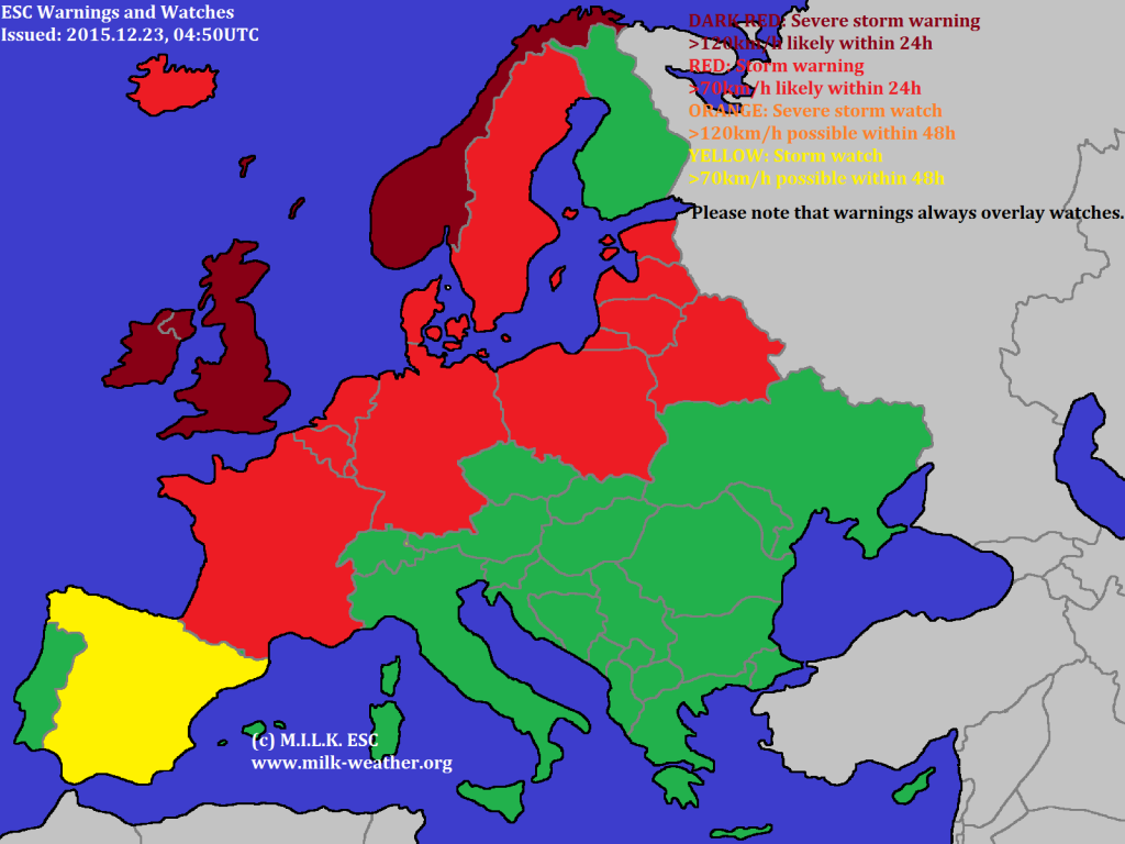
A new storm has now entered the stage, and is currently located to the W of the British Isles. At the same time, the storms BJARNI and AREND continue to exist, and BJARNI has even intensified – reaching peak gusts of over 190km/h in Norway, and with a central pressure of now only 954hPa. Storm AREND has stayed just as powerful as yesterday, however the airpressure has slightly increased.


