2016.10.18 – ESC European Windstorm Overview / Warnings / Watches

Here is today’s ESC European windstorm overview, issued October 18th 2016 at 10:20 UTC.

There is currently one storm system in the region.

Severe storm NICOLE is located over the Northern Atlantic. Its central pressure is 968hPa, peak gusts currently exceed 140km/h. The system is forecast to move towards roughly the north at a high speed, and is forecast to affect the west of Iceland towards the end of the 24-hour forecast period. Hurricane-forced storm gusts over 120km/h, possibly more, are to be expected and as the storm moves closer the wind speeds will likely further pick up (within the 48-hour forecast period). A severe storm warning has been issued for western Iceland due to the imminent threat from the severe storm NICOLE. Later during the forecast, on the second day, the storm is forecast to batter all of Iceland with severe storm gusts. Therefore, a severe storm watch has been issued for Iceland. Towards the end of the forecast period, NICOLE may also affect islands in the northern North Sea. Hence a storm watch has been issued there.

Below are the ESC overview as well as warnings/watches maps.

2016-10-18-esc

2016-10-18-warn

Dark red: Severe storm warning (>120km/h likely within 24h)

Orange: Severe storm watch (>120km/h possible within 48h)

Yellow: Storm watch (>70km/h possible within 24h)

2016.10.17 – ESC European Windstorm Overview

Here is today’s ESC European windstorm overview, issued October 17th 2016 at 10:40 UTC.

There are currently two storm systems in the region.

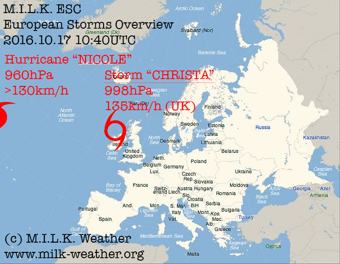
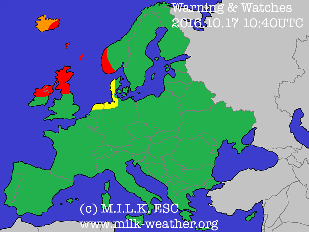
Storm “CHRISTA” is located to the north of Ireland. Its central pressure is 998hPa, peak gusts may currently exceed 95km/h over the North Sea, and a gust of 135km/h has been registered in the Cairngorn Mountains of the UK. The system is forecast to move roughly towards the North, and may bring some storm gusts to parts of the UK and Ireland within the upcoming 24 hours, hence a warning has been issued. The islands in the North Sea are expected to experience gusts over 95km/h, hence a storm warning has been issued for them. Further, storm warnings have been issued for the southwest coast of Norway and the southeast of coast of Iceland who are also expected to be affected by the storm.
CHRISTA is expected to split, with a new low pressure system moving towards the south over the north sea and possibly bringing storm gusts to the north sea coast of the Netherlands, Germany and Denmark towards the end of the 48-hour forecast period. Therefore, a storm watch has been issued for these regions.

Hurricane NICOLE is located over the Northern Atlantic. Its central pressure is 960hPa, peak gusts currently exceed 130km/h. The system is forecast to move towards the northeast with quite rapidly increasing speed, and is forecast to affect the west of Iceland towards the end of the 48-hour forecast period. Strong storm gusts over 110km/h, possibly more, are to be expected and as the storm moves closer the wind speeds will further pick up (outside of the 48-hour timeframe). Therefore, a severe storm watch has been issued for Iceland regarding Hurricane NICOLE

Below are the ESC overview as well as warnings/watches maps.

2016-10-17-esc

2016-10-17-warn

Red: Storm warning (storm gusts likely within 24h)

Orange: Severe storm watch (Severe storm gusts possible within 48h)

Yellow: Storm watch (Storm gusts possible within 48h)

2016.10.16 – ESC European Storm Overview

Here is today’s ESC European windstorm overview, issued October 16th 2016 at 15:15 UTC.

There are currently two storm systems in the region.

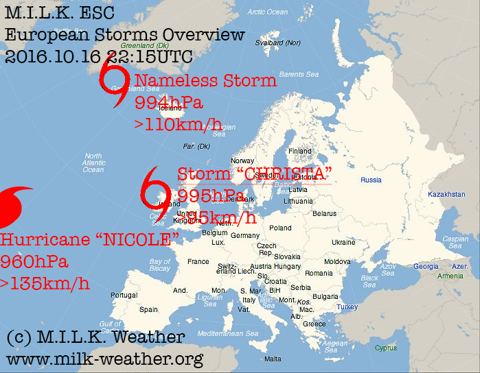
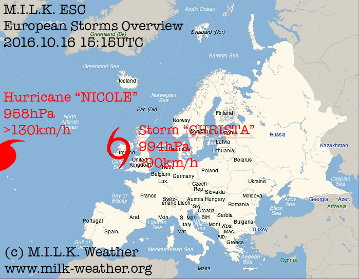
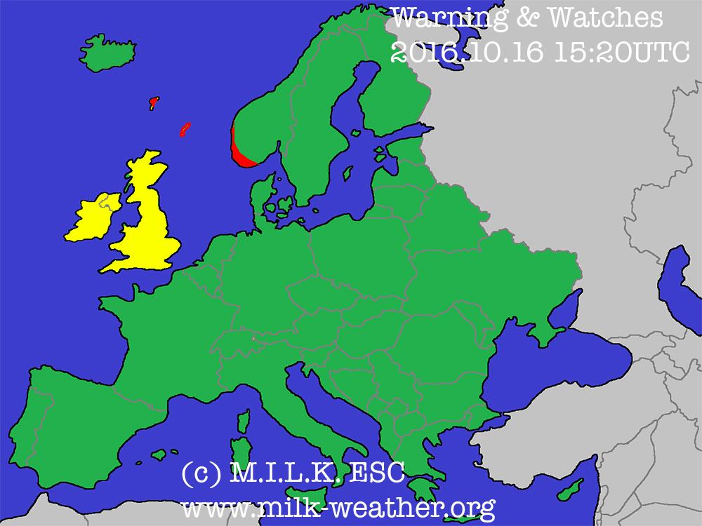
Storm “CHRISTA” is located over Ireland. Its central pressure is 994hPa, peak may currently exceed 90km/h over the North Sea. The system is forecast to move towards the North, and may bring some gusts around 75km/h to the UK and Ireland within the upcoming 24 hours, hence a watch has been issued. The islands in the North Sea are expected to have gusts over 95km/h, hence a storm warning has been issued for them.

Hurricane NICOLE is located over the Northern Atlantic. Its central pressure is 958hPa, peak gusts currently exceed 130km/h. The system is forecast to move towards the northeast gradually but with increasing speed, but will not affect any landmasses within the next 48 hours, hence not making any warnings or watches necessary.

Below are the ESC overview as well as warnings/watches maps.

2016-10-16-esc

2016-10-16-warn

ESC European Storm Overview (Issued 16.10)

Here is today’s ESC European windstorm overview, issued October 16th 2016 at 15:15 UTC.

There are currently two storm systems in the region.

Storm “CHRISTA” is located over Ireland. Its central pressure is 994hPa, peak may currently exceed 90km/h over the North Sea. The system is forecast to move towards the North, and may bring some gusts around 75km/h to the UK and Ireland within the upcoming 24 hours, hence a watch has been issued. The islands in the North Sea are expected to have gusts over 95km/h, hence a storm warning has been issued for them.

Hurricane NICOLE is located over the Northern Atlantic. Its central pressure is 958hPa, peak gusts currently exceed 130km/h. The system is forecast to move towards the northeast gradually but with increasing speed, but will not affect any landmasses within the next 48 hours, hence not making any warnings or watches necessary.

Below are the ESC overview as well as warnings/watches maps.

2016-10-16-esc

2016-10-16-warn

2016.10.08 – ESC European Storm Overview

Here is today’s ESC European storm overview, issued October 7th 2016 at 20:00 UTC.

There is currently 1 nameless storm in the region. Its central pressure is 987hPa, a peak gust of 102km/h has been registered in Iceland. The system is forecast to slowly move towards Iceland in the upcoming days, and is already affecting the island with peak gusts over 100km/h. Most affected is the southwestern coast.

Below are the ESC overview as well as warnings/watches maps.

2016-10-08

2016-10-08-warn

2016.10.07 – ESC European Storm Overview

Here is today’s ESC European storm overview, issued October 7th 2016 at 20:00 UTC.

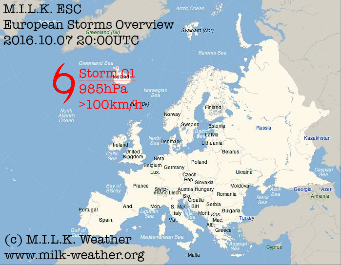
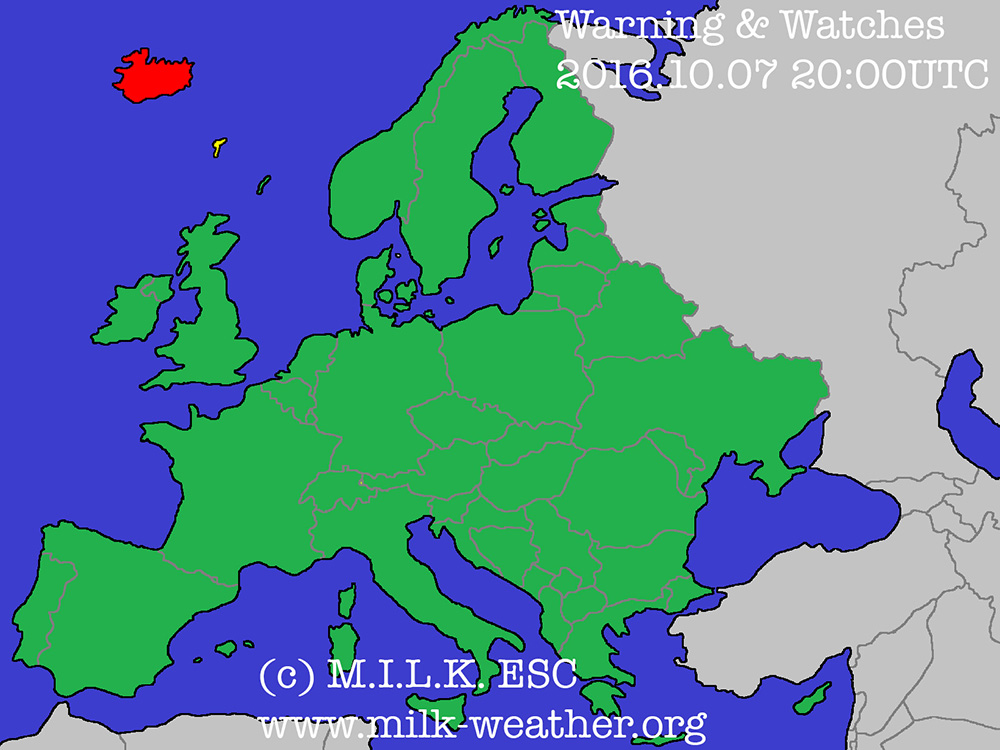
There is currently 1 nameless storm in the region. Its central pressure is currently 985hPa, current peak gusts are around 100km/h. The system is forecast to move towards Iceland in the upcoming days, and will make landfall on the island with peak gusts of around 70km/h, possibly more. Most affected will be the southwestern coast.

Below are the ESC overview as well as warnings/watches maps

2016-10-07

2016-10-07-warn


2016.08.05 – Convective Forecast

Here is a convective forecast for today. Especially in southern Austria, the conditions are right for the possible formation of severe thunderstorms as well. Live weather data is, as always, available on the MILK Weather network (www.milk-weather.org and www.milk-stormchasers.de)

2016.08.05

2016.06.25 – Convective Forecast

The weather setup with severe thunderstorms throughout central Europe is not over yet, and once more, very powerful thunderstorms may form over the course of the day, especially in the east of the forecast region. Main risks will be large amounts of rain (up to 80l/m² per hour), severe storm gusts exceeding 120km/h, hail up to >4cm in diameter, and an increased chance for a tornado event, especially in the evening hours.

2016.06.25