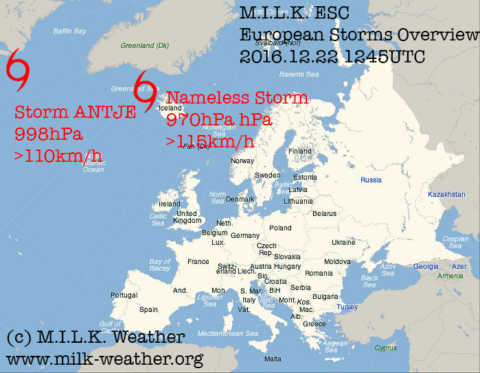
Forecast models suggest that a series of powerful storms will sweep through northern and central Europe around Christmas – here, we will take a closer look at what is expected as of now.
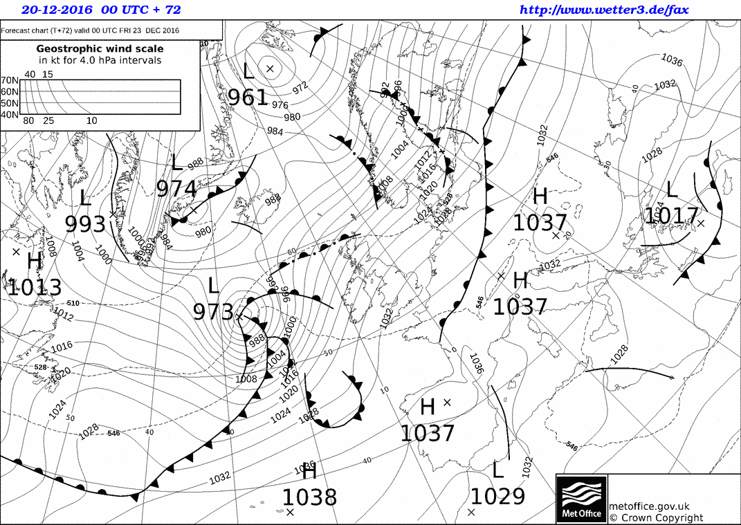
Below is the ground forecast for midnight (UTC) of the 23rd of December. A powerful, well-defined low-pressure system will have formed over the northern Atlantic to the west of the British isles, embedded in a lively westerly flow. Most of the storms in the previous days were located further north, around Iceland, although their storm fields sometimes extended far enough to the south to affect parts of the UK. This new storm, however, will be on a direct path to Ireland and the UK. At this point, gusts in the storm may exceed 165km/h over the open ocean.

Ground forecast of the UK Met Office for 00UTC on the 23rd of December.
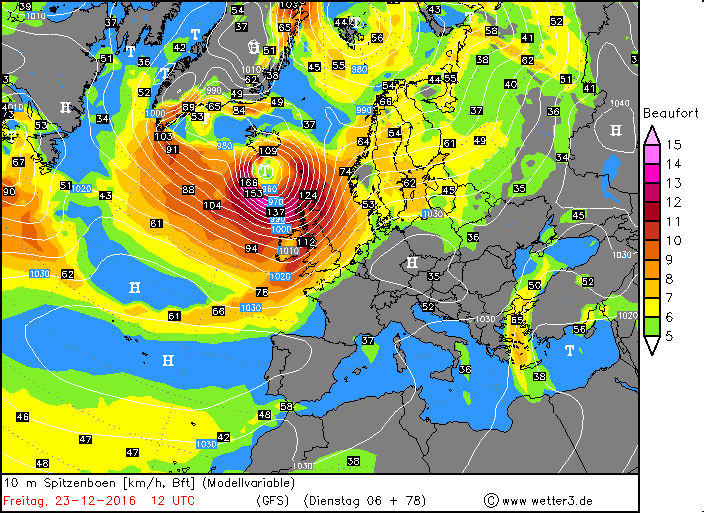
The storm will continue to intensify, and by 12UTC its center is predicted to be to the north of Ireland, with the low having deepened to a central pressure of 959hPa. Hurricane-forced storm gusts are to be expected in both the UK and Ireland – in the forecast map below, at 12UTC, the front system with the most intense winds has already passed Ireland and is located over the UK. The highest wind speeds are to be expected in the Scottish highlands and at the coasts of the northern UK.

GFS Forecast of the peak gusts at 12UTC on the 23rd of December.
In the afternoon and evening hours, the center of the low will move towards the northeast, however at the same time the area that the storm field covers will increase. At 18UTC, the most severe parts of the storm field will be located to the north of the British Isles (although it is possible that very intense hurricane-forced gusts over 140km/h affect the far north of the UK), and over the North Sea, where the system of fronts will be located. Large waves and high winds are to be expected at the coasts of Norway as well. In the evening, the fronts will be located off the North Sea coasts of the Netherlands, Germany and Belgium – along the coasts, gusts of around 100km/h are currently forecast, but except for Denmark, the storm field is not expected to move inland.
The storm will continue to rage especially in the northern half of the UK for the hours afterwards, and it will also be stormy in the Baltic and at some of its coasts. By the evening of the 24th, the storm will have weakened with its highest wind speeds in the North Sea and along the coast of Norway.
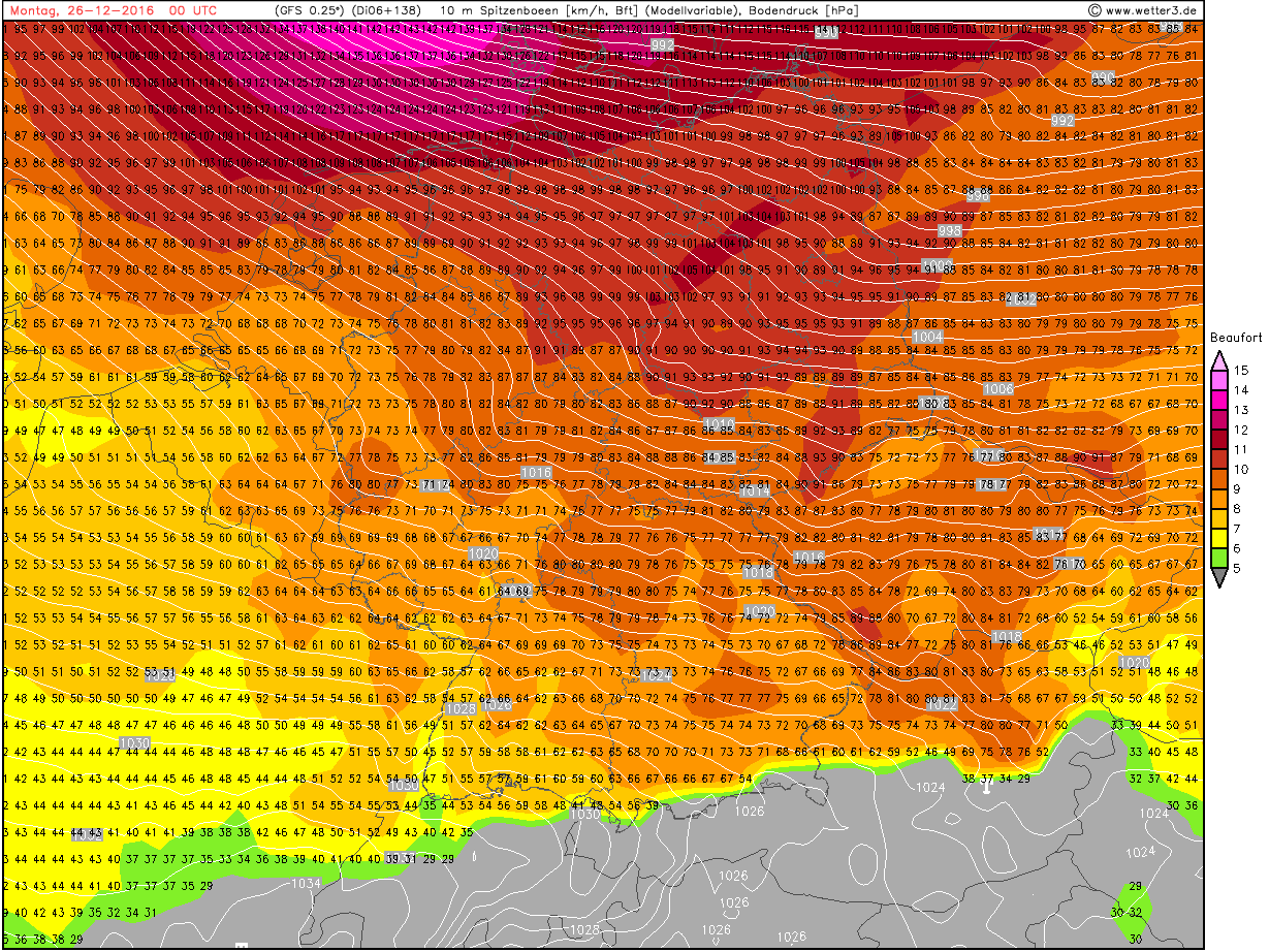
But at the same time, a new storm will form over the northern Atlantic to the west of the British Isles. It is expected to reach Ireland by 00UTC on the 25th, while still intensifying and moving towards the east. Gusts of up to 120km/h are to be expected in Ireland in that night, the UK might experience even higher wind speeds, especially in Scotland. The storm is not predicted to move to the northeast like the previous ones, but rather to keep heading east and cross over southern Scandinavia in the evening of the 25th, bringing extreme wind speeds of over 150km/h to the North Sea close to the shores of mainland Europe (the Netherlands, Germany, Denmark), and also gusts exceeding 120km/h to the Baltic. Unlike the previous storm, this time the storm field is expected to move far inland – Berlin, for example, is currently predicted to be hit by gusts around 110km/h.

GFS Peak gusts forecast for 00UTC on the 26th of December, 2016
The storm is then expected to quickly move away to the east, with a lively, at times stormy wind over most of eastern and eastern central Europe behind it.
That is a brief overview of what is forecast to happen as of now – keep in mind that it is still quite a while away and hence the forecasts may change quite significantly.


