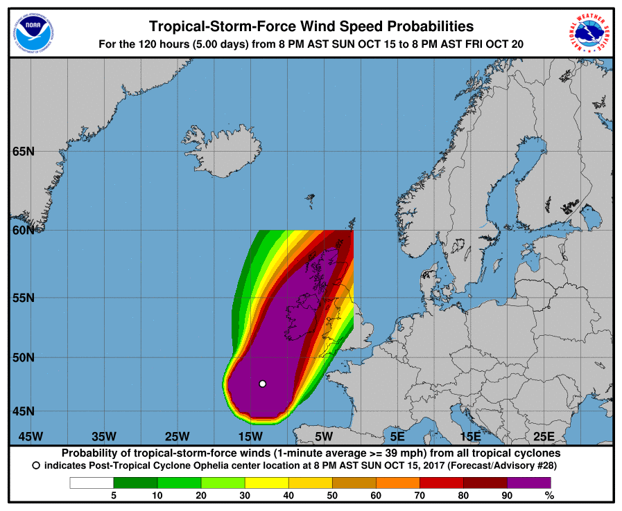
Hurricane-forced storm OPHELIA will make landfall in Ireland within the coming few hours. The storm, which used to be a hurricane further south over the Atlantic and continues to be tracked by the US’ National Hurricane Center, will come ashore packing winds comparable to those found in major hurricanes of the category three.
OPHELIA is currently located to the south-southwest of Ireland, with a central pressure of 963hPa (at 00UTC) and peak gusts exceeding 200km/h. The storm is not expected to weaken significantly before striking Ireland, and the wind field is expected to be large enough to also affect GB.
Gusts of around 200 km/h are expected throughout much of Ireland, and gusts exceeding 120km/h and reaching up to 180km/h are to be expected in GB, especially in Scotland, as well. It is an unusually powerful storm and has serious potential to cause damage and loss of life. Locals should follow all recent developments.
Aside from strong wind, waves that may reach up to 12 meters in height are expected to batter the southern coast of Ireland.
Below are the ESC European Windstorm Overview, as well as the warnings & watches. Due to the special situation, you will also find additional maps and information on storm OPHELIA.


