There are currently two storm systems tracked by ESC. The remains of Hurricane LEE have entered the forecast area, currently with a central pressure of 992hPa but still exceeding peak gusts of 115km/h. LEE, however, is expected to weaken within the next 24 hours and will likely not be considered a storm system in the next update.
The second storm currently being tracked is storm WOLFGANG. WOLFGANG will continue to intensify in the coming hours, and as soon as in 3 hours may be considered a “severe storm”, which gusts exceeding 120km/h. Currently, WOLFGANG’s central pressure is 977hPa and peak gusts are exceeding 110km7h.
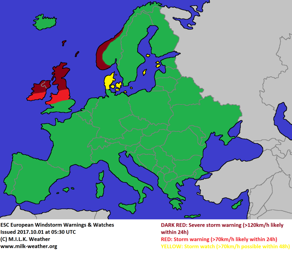
The wind field of WOLFGANG is expected to move east in the coming 24 hours. A severe storm warning has been issued for large parts of Ireland and the UK, meaning that gusts above 120km/h are to be expected in these areas when WOLFGANG strikes. The peak of the storm is generally expected to happen in the coming night. A severe storm warning has also been issued for the southern and southwestern coasts of Norway and the islands of the North Sea.
A storm warning has been issued for both Ireland and the UK, as gusts exceeding 70km/h are likely to take place all over the islands.
A storm watch has been issued for Denmark, as there is still uncertainty when the wind field will reach the country. Storm gusts may begin in the final hours of the coming night, or may only start moving in over the course of tomorrow.
A storm watch has also been issued for the Baltic Islands as storm gusts are expected to strike these areas tomorrow, and there is a slight chance for a storm watch to be extended to the Baltic Coasts tomorrow.
Below are the ESC European Windstorm Overview, Warnings and Watches.


