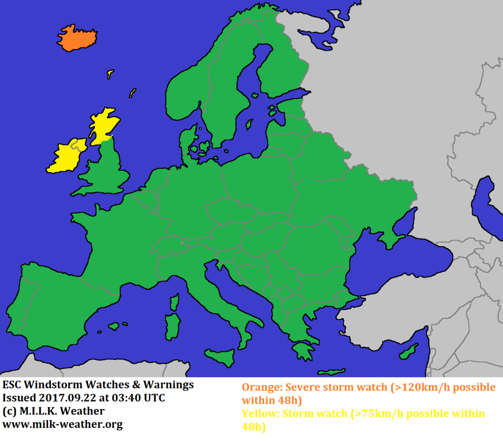
A new storm system has formed over the northern Atlantic. It is a well-defined low pressure area with a central pressure of 980hPa and gusts currently exceeding 110km/h. It has crossed the Atlantic eastwards on a direct course to the British Isles, but will be deflected by the high pressure system over mainland Europe so that the UK will be largely spared.
There is still a lot of uncertainty about where, when and with what intensity the storm field will reach land. A storm watch has been issued for all of Ireland, and storm gusts may arrive at the western coast as early as this evening. Tomorrow, storm gusts are possible throughout Ireland and in the northwestern parts of the UK. Towards the end of the 48-hour forecast period, the storm will reach Iceland. It is possible that the storm intensifies on the way there and then brings hurricane-forced gusts exceeding 120km/h to the island, hence a severe storm watch has been issued for Iceland.
Below are the ESC European Windstorm Overview, Warnings & Watches as well as a satellite image of the storm.


