We have a storm E of Greenland currently, but other than that, we have no storm systems in thhe European region currently. We will keep you updated.
2015.09.21 – ESC Overview: No storms, wind pattern
2015.09.19. – ESC Overview with a severe storm W of Iceland
2015.09.15 – Wind Pattern
The low-pressure area “Michael” is causing a few storm gusts in NW Europe, including the UK and the BeNeLux nations. However, the remaints of the (former) tropical storm HENRI are forecst to come ashore on the Iberian peninsula. Please be careful there – storm gusts are to be expected. Below is the peak gust analysis by GFS.
2015.09.14 – Wind pattern
Correction
The storm in the cntrl. N Atlantic marked as “HENRI” is in fact not HENRI, but rathen an unnamed storm. We are very sorry for the incorrect information.
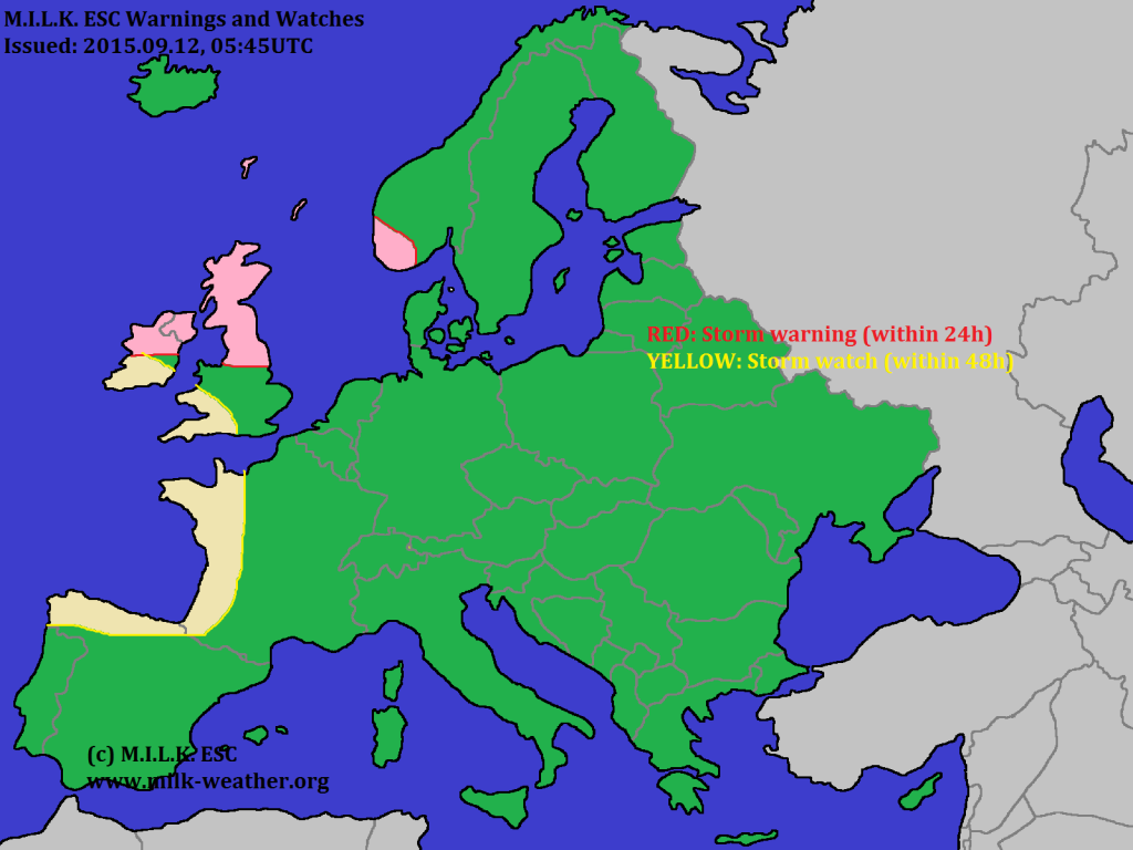
2015.09.12 – ESC Overview, Sat and Warnings
The scandinavian high-pressure area is starting to become much weaker, making it possible for low-pressure areas to move further towards the east again. At the edge of the H, storm “LEO” has formed, while the former tropical storm, now storm “HENRI” is moving towards Europe and is currently located over the central north Atlantic.
2015.09.11 – Stormy H-Pressure area: European Wind Pattern and pressure.
Currently we have no low pressure systems to report on, however a high over Scandinavia with a central pressure of 1037hPa. A the W side of the high, are stormy conditions, which affect mainly the north sea, but also Ireland, the UK, Norway and Iceland. Below is the wind analysis by GFS for yesterday evening, 18UTC.
Below is the pressure analysis of Europe at 00UTC, with the stormy high-pressure area and the stormiest area marked.


