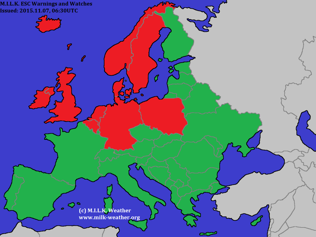
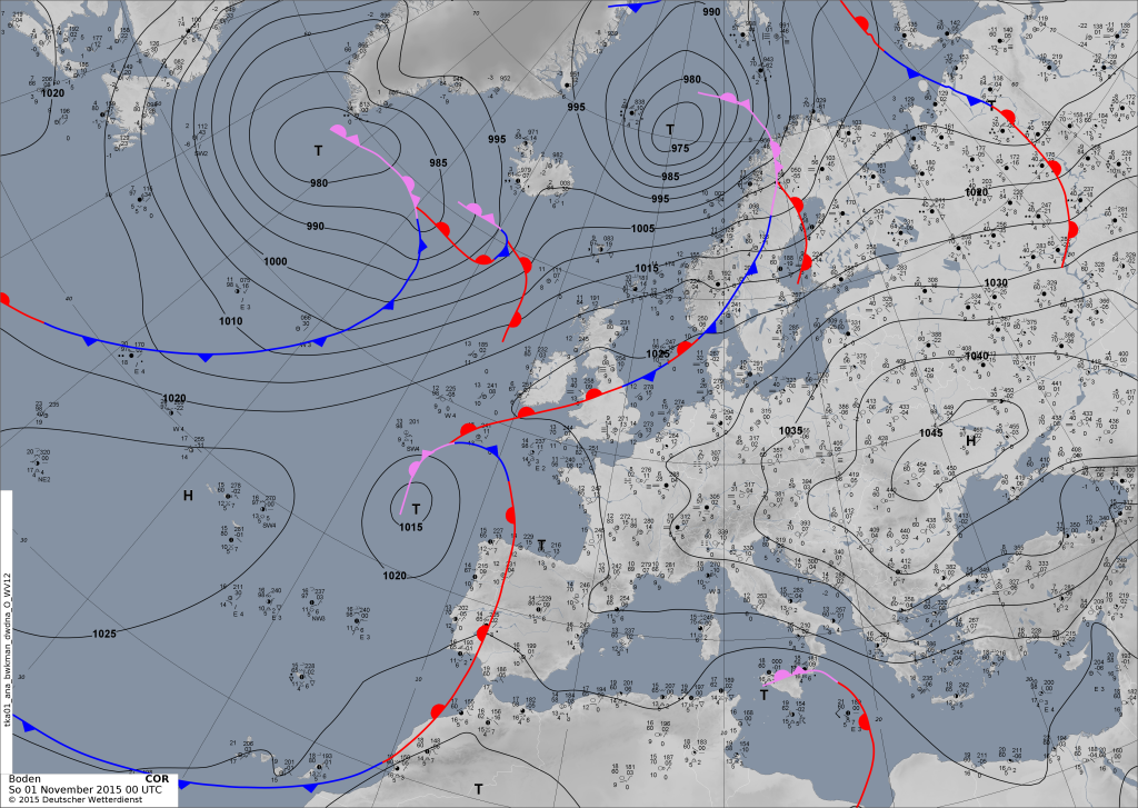
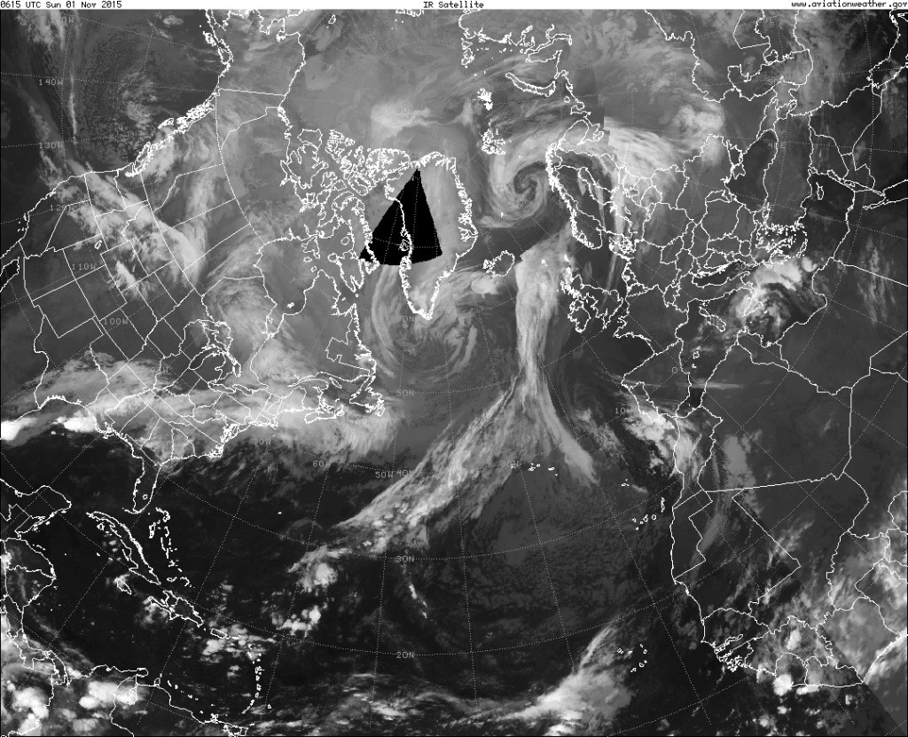
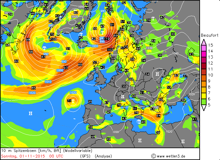
Currently there are three storms within the area that MILK ESC observes. Please note that the two storms in the south (not the one in Iceland) will intensify. In mainland Europe, the wind speed will be greatest at the coasts and on mountains.
2015.11.02. – Severe storm in N Europe, possible storm in Spain, France
There is currently a severe storm that will affect wide parts of northern Europe today, and is now located near Iceland. Warnings have been issued. There is also a low pressure area, named YORSCH II, over the Iberian peninsula. It is possible that this system will turn into a storm within the next 24 hours, but it is not totally sure. Therefore storm watches have been issued for both Spain and France. See below for more information.
2015.11.01. – ESC Overview: Two severe storms, warnings for N Europe
There are currently two storms in the MILK ESC warning area. One of them is currently located to the south of Greenland. MILK ESC calculated gusts of over 116km/h in this storm. It will move towards the east and affect everything from Iceland to the British Isles within 24h. The second, by far stronger, storm is located in the far N of Norway. Severe storm warnings have been issued for Norway and Sweden. See below for more information!
2015.10.27. – Storm WYMYAR and a new Storm
2015.10.25 – Severe storm WYMAR to make landfall in British Isles
The severe storm WYMAR is predicted to make landfall in the British Isles within 24 hours. Peak gusts in the storm currently are calculated to be near 150km/h, the central pressure currently is 979hPa. Below are the warnings that were issued. Red: Storm warning (within 24h) Yellow: Storm watch (within 48h).
The storm can be seen clearly in the satellite images as well.
2015.10.24 – Wind analysis of Europe
We currently have a storm low pressure system in the far N of Europe, currently affecting mainly Iceland and the coast of Norway. However, out on the open Atlantic a new, currently still weak, low pressure area has showed up – this is predicted to turn into a severe storm within 24h. We will keep you updated.
2015.10.23 – Storm VALENTIN in the N Atlantic, showers in Greece
Currently there is only one storm system in the European / N Atlantic region, named storm VALENTIN. However, there are still thunderstorms and strong showers caused by a low over Greece. Locally, there can be storm gusts again there.
Storm VALENTIN is currently affecting mainly Iceland and the Faroe Islands. See the Wind Analysis for further details about the region affected.
2015.10.22 – Severe storm ULI in the morning hours
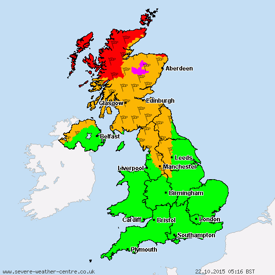
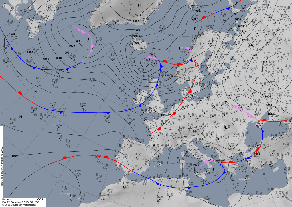
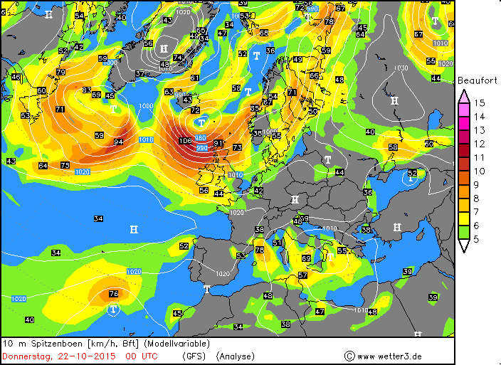
The warm front of severe storm ULI made landfall yesterday evening in the British Isles, and the cold front followed in the early morning hours of today. A peak gust of 141km/h was registered at the station “Bealach Na Ba No2” in the far N of the UK. The pressure of the storm has inreased from 971hPa (yesterday evening) to 977hPa (00UTC).
2015.10.21 – severe storm “ULI”
For more information about Storm ULI visit the MILK ESC Website, the MILK ESC Blog, or the MILK Home Meteorologist module
2015.10.21 – ESC Overview, severe storm “ULI” and nameless storm
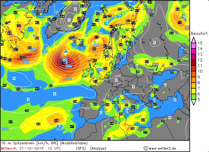
We currently have two storms in the European region, one of which is called “ULI” and considered a severe storm. Peak gusts of over 128km/h have been calculated by the ESC. The bad news: The storm is currently making landfall in the UK and Ireland. Therefore, the MILK ESC has issued warnings. There is also a second, smaller storm currently making landfall on the Scandinavian peninsula, respective warnings have been issued. A peak gust of 130km/h has been measured in Norway. The two storms have central pressures of 971hPa (ULI) and 977hPa (Nameless storm). below is the MILK ESC Overview.

