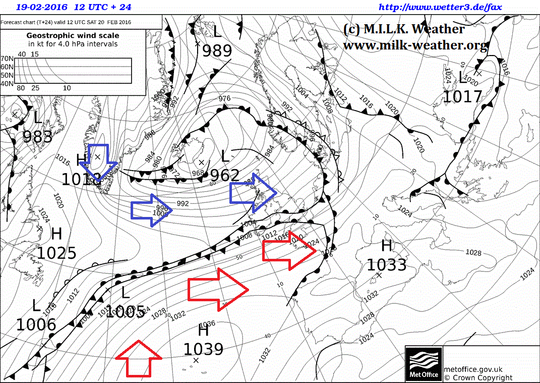
On Saturday, the frontal system of Storm XIN (See the M.I.L.K. European Storm Center) will advance further to the east. Following behind is a cold and windy maritime-polar air mass flowing from Greenland over the UK and into Scandinavia. However, the polar front will be well defined tomorrow and will also stretch quite far to the east. The front will seperate the cool, arctic air mass in the north from a much milder, yet still humid air mass to the south. The edited UK Met. Office ground prediction map for tomorrow, 12UTC shows the way the air masses travel.
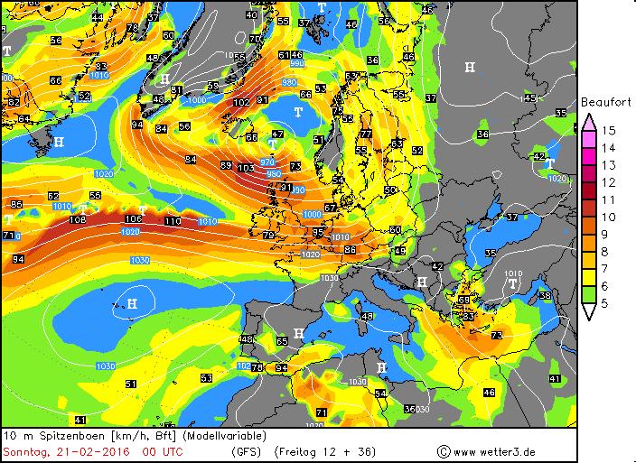
Along the polar front and around storm XIN, storm gusts are to be expected, and regionally, damaging winds are possible. Wind speeds are expected to reach their maximum along the coasts of the North Sea and especially in the north of the UK in the night from Saturday to Sunday. Below is a current GFS forecast map for the peak gusts at 00UTC in the night from Saturday to Sunday.
Once again, the M.I.L.K. ESC (European Storm Center) will keep you updated.
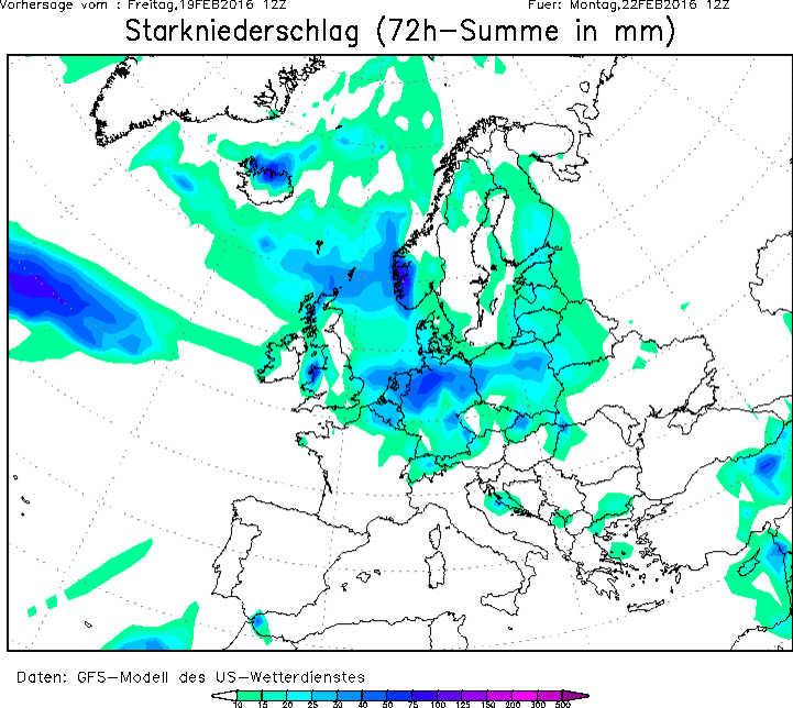
With the advance of the warmer air mass into Europe and especially along the polar front, quite significant amounts of rain (in the mountains snow) can accumulate, and there is a risk of local flooding. Current forecasts for Saturday predict the greatest amounts of rain to fall along the north of the Alps and in the Netherlands. In southwestern Norway, quite a bit of snow is expected to fall.
Over night, the warm air mass over mainland Europe will continue to advance eastward, bringing partly heavy rainfall (and possibly storm gusts) at the leading edge.
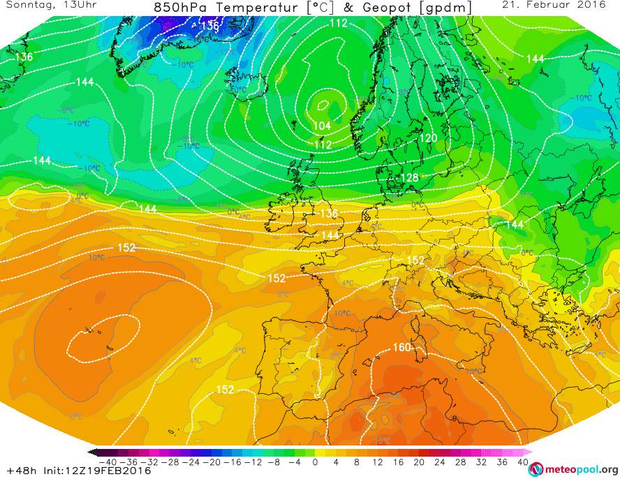
On Sunday, the overall weather situation in Europe will be calmer, because the change in the weather pattern will be more or less complete. Strong rain will, however, continue to fall especiall in the Netherland and northern Germany, and strong precipitation will also continue in southwestern Norway. The Mediterranean will be dominated by friendly high-pressure weather, and the low-pressure system that will dominate in Greece on Saturday and bring showers will have moved on to Turkey. There will be a clear division between the mild air mass over mainland Europe and the cold polar-maritime air mass further north over Scandinavia and the North Sea. This division can be clearly seen in the GFS prediction for temperatures at 850hPa level for Sunday, 12UTC.
Over the course of the afternoon, an advance towards the south of the cool air mass will begin over the British Isles.
In total, there might be some quite significant amounts of precepitation in some parts of Europe, especially southwestern Norway and Northern Germany. Below is the predicted amount of precipitation until Monday, 12UTC.


