2017.01.28 – Weather Forecast for Rabat

TODAY may start off with quite a bit of clouds, but later the sky is expected to clear and it will stay mostly sunny at least for the second half of the day. The temperatures this morning start off at 12 degrees and are expected to reach a maximum of up to 19 later during the day. No precipitation is expected, and the wind will be mainly light.

TOMORROW there will be close to no clouds and hence a lot of sunshine. In the morning, the wind may still be fairly noticeable, but during the day it will lost intensity. The temperatures are forecast to range from 7 to 19 degrees Celsius.
On MONDAY it will stay very cloudy or overcast for the majority of the day, only shortly before sunset the sky is expected to clear. The wind will be quite light, and temperatures are forecast to be quite warm, reaching from 11 deg. C in the morning to 22 Centigrade later on during the day.
TREND:
Tuesday: Sunny, 13 to 22C
Wednesday: Fair, 11 to 20C
Thursday: Rainy, 10 to 16C
Friday: Mostly sunny, 10 to 19C
Saturday: Sunny, 9 to 20C
Sunday: Fair, 12 to 20C

2017.01.05 – Snow in central Europe

This morning many people in Germany and parts of Austria woke up to fresh snow outside their homes. The current air mass is quite cool but nonetheless moist thanks to its origin from the Arctic, and therefore poses ideal conditions for snow to fall.

Snow depth this morning (05.01.) at 07:00 local time

2017.01.01 – New Year’s Weather in Europe

Happy new year everybody! And let’s get straight into an overview of the weather situation in Europe on the first day of 2017.

Europe is currently dominated by high-pressure weather. The dominant high that was located over the Alps yesterday has weekend a bit and moved further south, with a couple different centers of high pressure being located just to the north of the Mediterranean. A strong high pressure area is located over the northern Atlantic NW of the British isles and to the south of Iceland, which is pushing cold air from the Arctic towards the south at its eastern flank. At the leading edge of this cold air, a cold front results in a clearly noticeable change of air masses, with quite a bit of rain and also windy weather. The cold front is currently located across the very south of the UK. Because of the high pressure influence, the temperatures are similar throughout Europe, being a bit below freezing at around 0 to -8 degrees Celsius in the morning, and reaching a maximum of 0 to 4 degrees during the day. It will also be largely dry in mainland Europe, however the cold air advancing from the north and especially the cold front at the leading edge will bring some precipitation, largely in the form of rain in the lowland. There may be some snow as the front moves into Germany at night, however.

2016.12.31 – Europe Meteorological Situation Overview

Mainland Europe is currently dominated by a strong high pressure area located over the Alps. In the eastern Mediterranean, a low pressure system brought heavy precipitation, in many cases in the form of snow, to Greece and surrounding regions, while Scandinavia is being battered with wind and precipitation as a low pressure system is moving across the peninsula. A cold front is crossing over the British isles from the north-northwest with cooler air trailing behind, bringing storm gusts in the process. In most of mainland Europe, temperatures are slightly below freezing at night and reach low positive values during the day, with the Balkan and Scandinavia being the exceptions where it is cooler.

2016.12.30 – When will there be winter in (central) Europe?

So far, this winter was fairly mild and also unusually dry throughout large parts of Europe – but recent runs of the forecast models suggest that that might change soon. Currently, cold air is located over the Balkan, which even led to snow falling in Greece with pictures of the Acropolis covered in snow. The temperatures stay below 0 degrees Celsius even during daytime in the region. However in the rest of Europe to the north and west, the temperatures range from around 0 to 5 degrees.

The map below shows the current snow cover in Europe and the altitude at which the temperature reaches 0 deg. C (in meters) – as you can see, western and central Europe have absolutely no snow except for in the mountains, and the altitude of 0 degrees Celsius is located at around 2,000m.

The reason why it is cold in the southeast but comparatively warm but nonetheless dry in the rest of Europe is a high pressure area located over central Europe, which moves the cold air from Russia to the southwest towards the Mediterranean, while keeping upright a flow of mild air from the southwest and west towards the rest of Europe. The high is also blocking the rain coming from the Atlantic, though, resulting in the unusually dry weather for this season.

Towards new year’s eve, however, this high-pressure system is expected to weaken while at the same time a new one will form over the northern Atlantic and start to move east gradually. Ahead of that new high, the wind direction in central Europe will turn from west to north, and with the wind from the north comes cooler air.

A cold front will be located at the leading edge of this cold air mass, hence precipitation in liquid and solid form is to be expected. The level at which 0 degrees Centigrade are reached will fall to 200m, in some places possibly even right down to 0m. Except for Scandinavia, the first ones to be affected by this cold air will be the British Isles (UK and Ireland), with snow falling throughout Scotland and possibly even in some lower-lying areas of England. On the 2nd of January, the snow is then also expected to reach France, Germany and possibly Austria and Switzerland, with the largest amounts of snow expected to fall at the northern side of the Alps.

Although there will be snow, the temperatures will still range from around -3 to +5 degrees every day, and especially in the northern parts of central Europe the snow is expected to melt.

On Friday, new snow is expected to fall throughout large parts of Europe, and it will continue throughout the weekend especially in the Alps and the southern half of Germany, resulting in a predicted snow cover of over 10cm in some low-lying areas.

This is a brief overview of what is expected to happen in terms of winter in (central) Europe AS OF NOW; please do take note that these forecasts are still quite long-term and hence may change in the coming days.

2016.12.26 – ESC European Windstorm Overview / Warnings / Watches

This is the ESC European Windstorm Overview, issued at 0700UTC on the 26.12.2016

There are currently 2 storm systems in the region.

Severe storm BARBARA will be moving through northern and central Europe today, bringing with it wind gusts in part over 200km/h. BARBARA is currently located in the North Sea with a central pressure of 951hPa. The storm field is largely located to the south of the storm’s center. Storm BARBARA is expected to move across Scandinavia and then reach parts of central Europe in the coming night. Severe storm warnings were issued for the North Sea Islands, where the storm is already raging at hurricane-force, and also for the north of the UK, where the currently highest wind gusts are being registered. Later, the coast of Norway and afterwards southern Norway, Sweden, the entirety of Denmark and some Baltic islands will be battered by hurricane-forced winds. In the coming night, the wind field will move further inland on mainland Europe (mainly Germany and Poland), and will also reach major cities such as Berlin. Storm warnings were issued. As the storm loses structure tomorrow, there may be storm gusts in other parts of Scandinavia, in the Baltic and in central eastern Europe as well; storm watches were issued.
Peak gusts of storm Barbara:
238km/h – Cairngorm Mountains, UK
183km/h – Aonach Mor, UK
176km/h – Cairnwell, UK
172km/h – Soervaag, DK
172km/h – Thorshavn, DK

A new severe storm has formed off the coast of Canada, with peak gusts exceeding 135km/h and a central pressure of 980hPa. It is expected to cross the Atlantic today and into tomorrow, but will miss mainland Europe and instead dissipate as it moves to the northeast of Iceland.

Below are the  ESC Overview as well as warnings and watches maps.

2016.12.26 – Vorhersage für BERLIN & Forecast for DEN HAAG

Vorhersage für BERLIN:


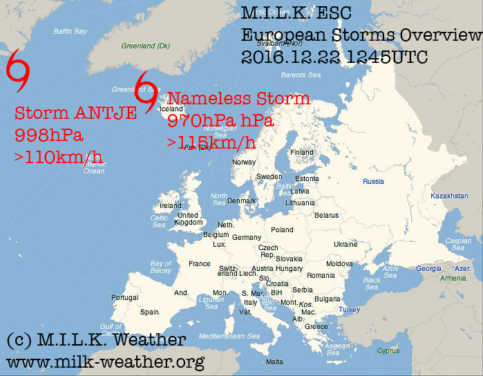
HEUTE ist es die meiste Zeit bedeckt, im Tagesverlauf zieht auch noch ein Regengebiet durch. Erst hinter dieser, also nach Sonnenuntergang, wird die Wolkendecke etwas auflockern. Die Temperaturen liegen heute früh um die 9°C und werden im Tagesverlauf noch sehr milde 11°C erreichen. Das Hauptthema heute bleibt aber mit der Annährung des Sturms „Barbara“ zweifelsfrei der Wind – Tagsüber muss mit Böen bis 60km/h gerechnet werden, bevor der Wind in den Abendstunden deutlich zulegt.

Die höchsten Windgeschwindigkeiten, mit SCHWEREN STURMBÖEN von bis zu 95km/h, werden in den frühen Morgenstunden vom Dienstag erwartet.

Am Dienstag ist es tagsüber meist stark bewölkt, ab und zu kann es auch ein paar Regentropfen geben, die Temperaturen reichen von 3 bis 7°C. Im Tagesverlauf wird der Wind wieder recht rasch nachlassen, und bis zum Abend ist Sturm „Barbara“ dann im Wesentlichen durch.


Am Mittwoch bleibt es voraussichtlich den ganzen Tag über grau und regnerisch, Sonnenschein ist keiner zu erwarten. Die Temperaturen werden den ganzen Tag über um 6°C liegen, und der Wind wird wieder leicht sein.


TREND:


Donnerstag: Zunehmend freundlich, 3 bis 5°C

Freitag: Sonnig, -1 bis +4°C

Samstag: Sonnig, -2 bis +3°C

Sonntag: Bewölkt, -2 bis +3°C

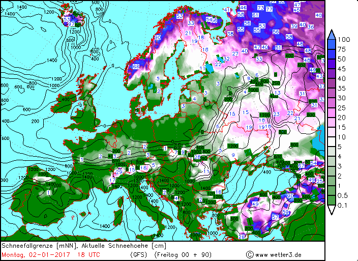
Montag: Regen und Schnee, -2 bis +2°C

Dienstag: Sonne, -4 bis +1°C

Mittwoch: Bedeckt, etwas Schnee, -3 bis +2°C


Forecast for DEN HAAG:


TODAY will start off with a lot of rain, but after the passage of this front the sky may clear a bit and there might be some sunshine before the sun sets in the afternoon. It is fairly mild today, with temperatures staying around 11°C all day long. Unlike Berlin, which is forecast to be battered by storm “Barbara” coming night, the wind is expected to stay fairly calm in Den Haag, with gusts not exceeding 60km/h.


TOMORROW the weather is going to be a lot friendlier; only few clouds are expected in the sky during the day, so it is expected to be quite sunny. The temperatures will range from 7 to 9°C and the wind will be very light.


WEDNESDAY will start off with thick fog, which may stick around until late into the day. After it dissolves, however, no clouds are expected so it will be sunny for the rest of the day. It will be quite a bit cooler than the previous days as well, with temperatures between 1 and 7°C. The wind will continue to be light.


TREND:


Thursday: Sunny, 0 to 5°C

Friday: Overcast, 1 to 7°C

Saturday: Partly cloudy, 5 to 7°C

Sunday: Rain, 2 to 5°C

Monday: Partly cloudy with showers, 4 to 7°C

Tuesday: Mostly sunny, 0 to 4°C

Wednesday: Mostly cloudy, 1 to 6°C

2016.12.25 – ESC European Windstorm Overview / Warnings / Watches

This is the ESC European Windstorm Overview, Issued at 0630UTC on the 25.12.2016

There is currently 1 storm system in the region.

Storm BARBARA, currently just to southwest of Iceland with a central pressure of 961hPa is moving towards Europe. It is currently the only storm system watched by ESC in Europe. BARBA is expected to bring hurricane-forced gusts to parts of Europe. A severe storm warning was issued for the northern parts of Ireland and the UK, where gusts above 125km/h are to be expected in the passage of the storm’s fronts today. The highest wind speeds, in part above 180km/h, are to be expected on exposed mountaintops in Scotland. A severe storm warning was also issued for the islands of the North Sea, where gusts may exceed 150km/h as the storm field moves through towards Scandinavia. Storm gusts are also to be expected in the rest of Ireland and the UK, Iceland, mainland Denmark, the North Sea coast of the Netherlands and Germany within 24 hours. BARBARA is expected to cross Scandinavia tomorrow, making a severe storm watch necessary for all of southern Norway and Sweden and some of the Baltic islands, and a regular storm watch for the remaining Baltic islands as well as the eastern and southern Baltic coasts and some of mainland Germany. See the warnings and watches map below for details.
BARBARA’s current peak gusts of today:
181km/h – Cairngorn Mountains, UK
165km/h – Cairnwell, UK
154km/h – Aonach Mor, UK

Below are the ESC Overview and warnings / watches maps:

2016.12.25 – Vorhersage für BERLIN& Forecast for DEN HAAG

Vorhersage für BERLIN


Heute bleibt es den ganzen Tag über bedeckt und regnerisch. Die Temperaturen sind sehr mild und werden im Tagesverlauf von 5 auf bis zu 10°C steigen. Der Wind ist recht lebhaft und kommt aus Westen; Spitzenböen von bis zu 65km/h sind zu erwarten.


Morgen ist es mit Durchzug einer weiteren Front erneut Regnerisch und ungemütlich, am Nachmittag in Richtung Sonnenuntergang wird es dann voraussichtlich aufhören; dann sollten auch die Wolken etwas aufreißen. Die Temperaturen werden den ganzen Tag über zwischen 9 und 11°C liegen, und der Wind wird weiterhin lebhaft bis stürmisch aus Südwesten, später Westen, kommen. Der Wind wird im Tagesverlauf zunehmen.

In der Nacht auf Dienstag ist mit Sturmböen bis zu 85km/h zu rechnen.

Am Dienstag ist es dann wolkig, immer wieder kann es allerdings auch sonnige Abschnitte geben. Großteils sollte es trocken bleiben, auch wenn einzelne Schauer nicht ausgeschlossen werden können. Die Temperaturen liegen in der Früh um 4, später bei etwa 8°C.


TREND:

Mittwoch: Regnerisch, 6 bis 7°C

Donnerstag: Wechselnd bewölkt, 2 bis 4°C

Freitag: Sonnig, -1 bis +4°C

Samstag: Sonnig, -2 bis +3°C

Sonntag: Meist sonnig, -2 bis +2°C

Montag: Schnee, 0 bis 2°C

Dienstag: Heiter, -5 bis 0°C


Forecast for DEN HAAG:


Today it will stay overcast throughout the entire day, however it should stay mostly dry. The temperatures will range from 8°C in the morning to a maximum of around 11°C later during the day, and the wind will be lively, in part stormy, with peak gusts of up to 70km/h.


Tomorrow will start off with rain, thanks to the passage of another front, however later the rain is expected to stop and the sky may even clear up a few hours later. The temperatures will stay around 8 or 9°C all day long. The wind will stay lively, with gusts around 65km/h.


Tuesday will be a lot friendlier; no precipitation is expected and it will be mostly sunny all day long with temperatures from 6 to 8°C. The wind, coming from the northwest, will be fairly light.


TREND:


Wednesday: Sunny, 2 to 7°C

Thursday: Sunny, 0 to 6°C

Friday: Fair, 0 to 6°C

Saturday: Rainy, 3 to 6°C

Sunday: Rainy, 4 to 6°C

Monday: Rainy, 4 to 6°C

Tuesday: Chance of snow, -1 to +4°C

2016.12.22 – ESC European Windstorm Overview / Warnings / Watches

This is the ESC European Windstorm Overview, issued at 1300UTC on the 22.12.2016

There are currently two storm systems in the region.

A nameless storm is located near Iceland,  currently causing windy weather over the UK and in the mountains of Norway. It is, however, expected to weaken so much that it will not be considered a “storm” by ESC within the next 12 to 24 hours.

Storm ANTJE is located off the coast of Canada and will move across the northern Atlantic in the coming 24 hours, reaching Ireland and the NW of the UK towards the end of the 24-hour forecast period. Therefore, storm warnings have been issued for those regions. A severe storm watch has been issued for the North Sea Islands and a regular storm warning was issued for Iceland. The storm will then continue to move further towards Europe, making a storm warning necessary for the coast of Norway as well as parts of central Europe – the Netherlands, northwestern Germany, and Denmark. Warnings were also issued for the islands in the Baltic and some coastal areas in the Baltic States and in Finland.

Below are the ESC Overview, as well as the warnings and watches maps.

Red: Storm warning (>70km/h likely within 24h)

Orange: Severe storm watch (>120km/h possible within 48h)

Yellow: Storm watch (>70km/h possible within 24h)