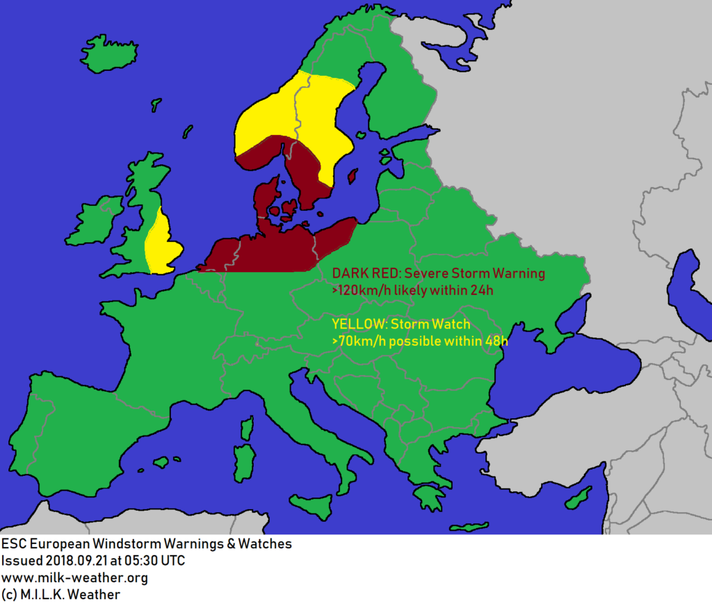
Storm ELENA, which has crossed the UK in the night from Thursday to Friday and its currently making its way into the North Sea, will bring a good deal of wind to northern central Europe today.
The storm currently has a central pressure of 986 hPa and packs wind speeds of over 140km/h, however is expected to further intensify, eventually reaching peak gusts of up to 190km/h in its center.
Denmark will likely be the hardest hit in terms of wind speeds; especially in exposed locations and at the northwestern coast, peak gusts may reach full hurricane-force, possibly exceeding 160km/h.
The Netherlands should expect stormy conditions to commence within the next few hours, bringing wind speeds of 70-100km/h to much of the country and peaks of up to around 120km/h at the coasts.
In Germany, the North Sea coast and its islands should brace themselves for storm gusts in the range of 100 to 120km/h. Further inland, a strong cold front will move from west to east over the north of Germany, bringing not only a drop in temperatures by up to 20°C in very short time, but also potentially hazardous storm gusts which may locally exceed 100km/h.
This same cold front will move into Poland, affected especially the west and northwest of the country before it lessens in intensity overnight.
In Sweden and Norway, storm gusts are mainly expected at the southern coasts and in exposed locations such as mountain peaks, however there are uncertainties in the forecast and how far north the wind field will reach.
Below are the Windstorm overview and the windstorm warnings and watches for Europe.
This forecast is solely for informative purposes and though is done to the best of the forecaster’s ability, no warranty is given for the accuracy of the information.


